About AmazoniaForever360+
AmazoniaForever360+ is a free tool initiated by the IDB as part of its Amazonia Forever program to help all those involved in the development and conservation of the Amazon better understand this immense and complex territory. The platform is designed to evolve alongside the needs of its users and partners across the region and beyond.
Key Features
Generate Reports in Minutes
Create customized reports focused on your areas of interest, with actionable insights and data visualizations generated instantly from our comprehensive territorial knowledge base.
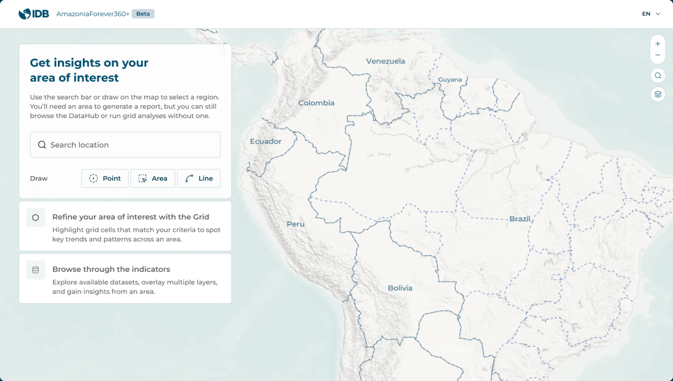
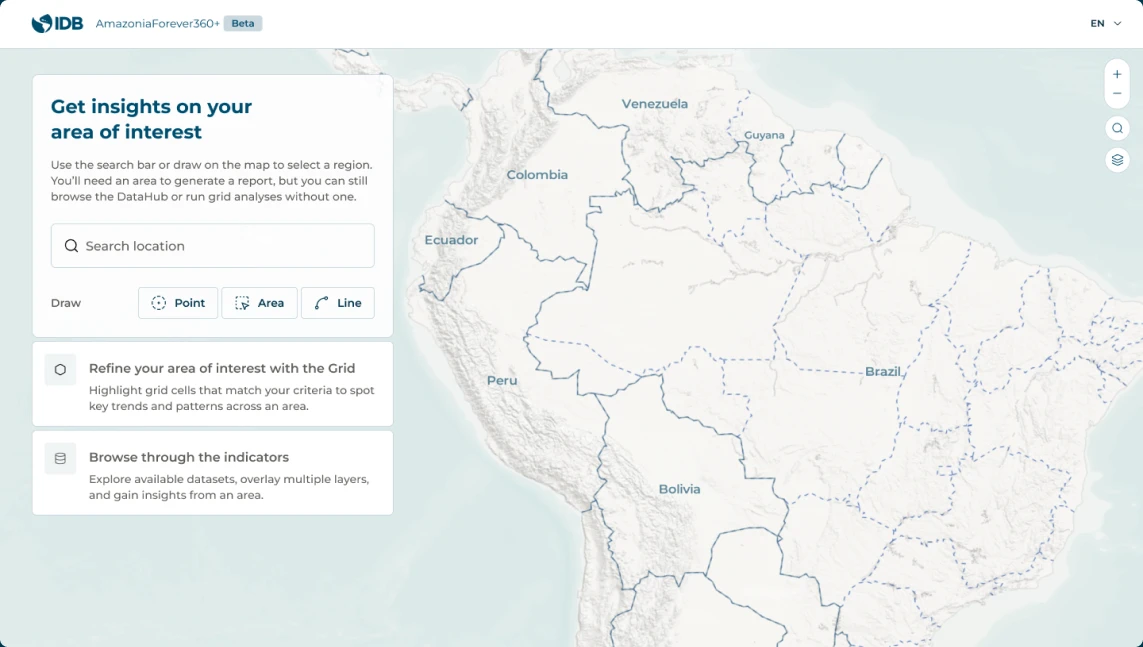
Select area of interest
Define topics of interest
Share and download


Key Features
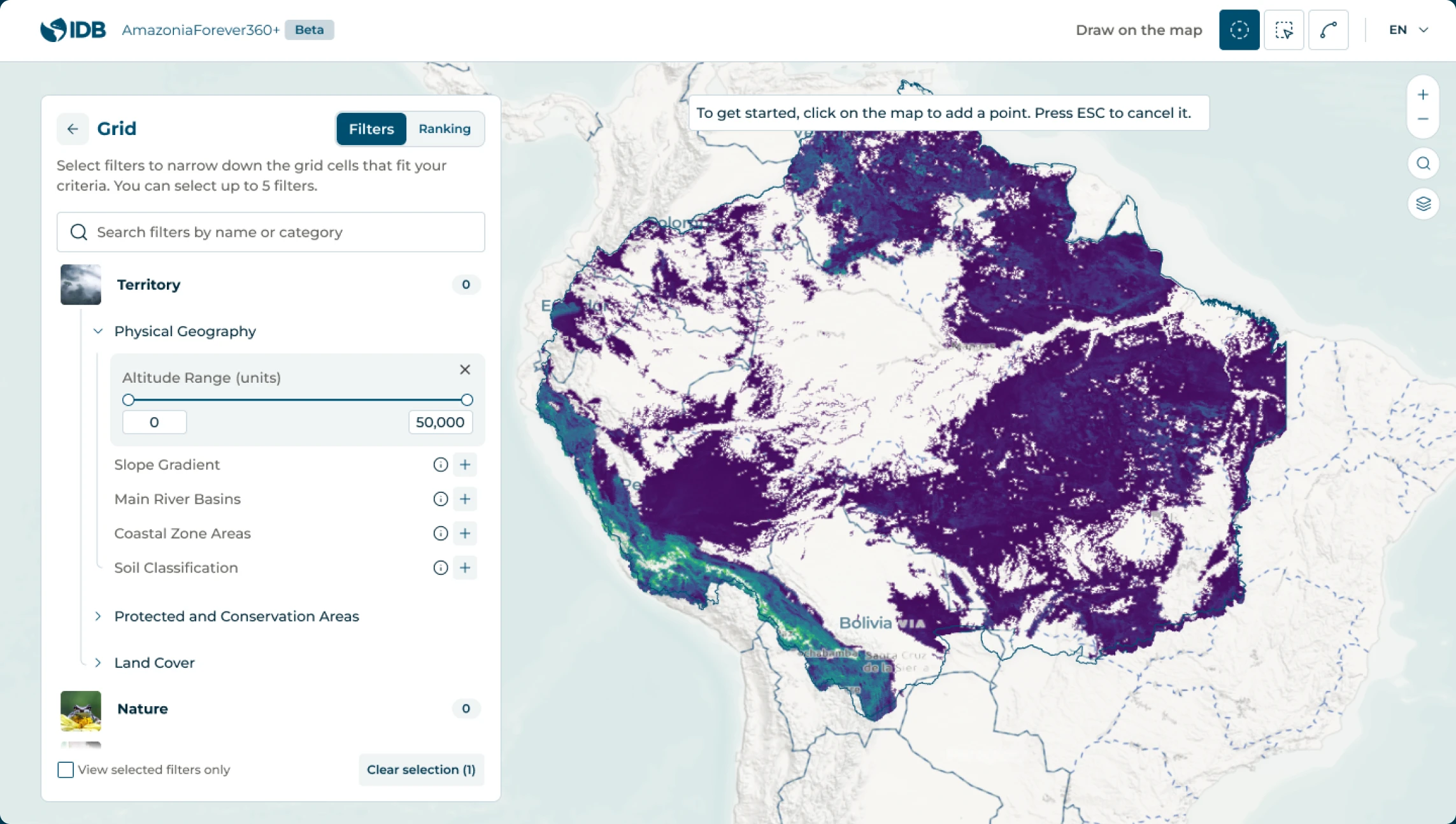
The power of Amazonia Grid
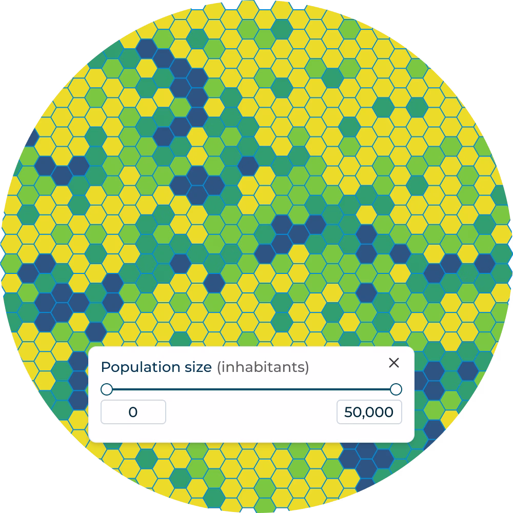
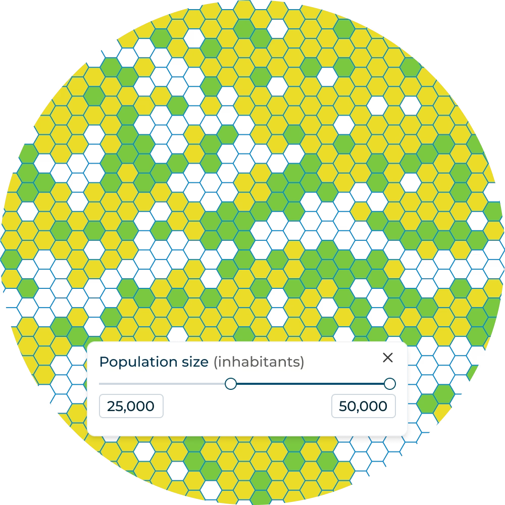
Grid-Powered Analytics Beyond the report, dive deeper into your selected area using our standardized hexagonal grid system to play with indicators and identify locations that match your specific criteria, from biodiversity hotspots to demographic patterns.
Identify hotspots
Redefine your area
Create report
information on
A wide range of indicators from different topics
Navigate through a curated selection of topics to uncover the Amazonia's multifaceted story. From environmental to socioeconomic dynamics, our platform brings you a comprehensive perspective.
Amazonia at a glance
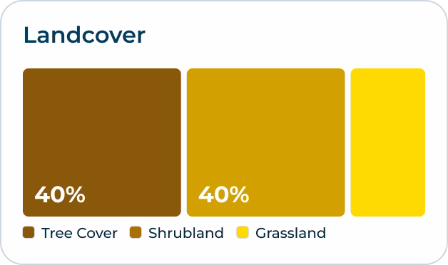
A mosaic of ecosystems and habitats
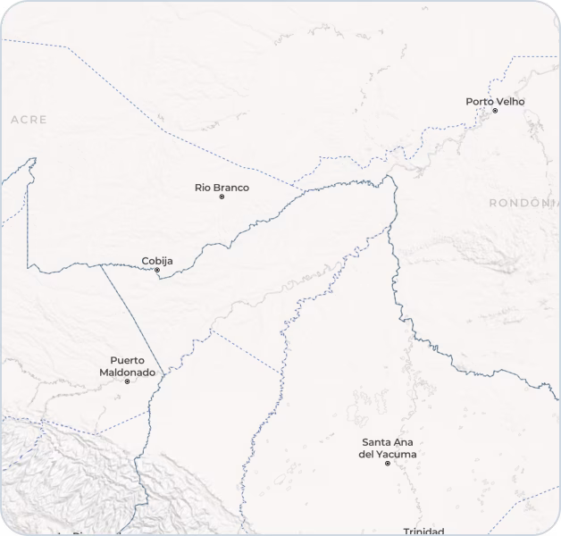
A Continent-sized Mosaic of Cultures and Nature Across Eight Countries Spanning 8.4 million square kilometers across eight South American countries, Amazonia represents one of the planet's most diverse confluences of cultures and ecosystems.
Select indicator
Source:
- Global Human Settlement Layer (GHSL) - Population projection for 2025;
- Cartographic area
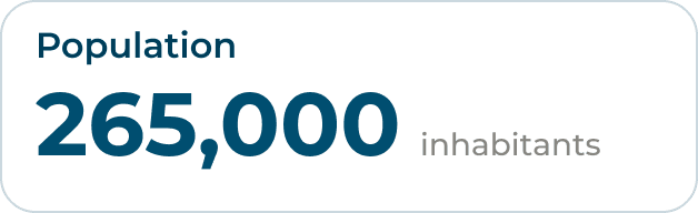
Distribution of Amazonia’s Population by Country (%)
Percentage of a country's population residing in its Amazonia Forever work area
Source:
- Global Human Settlement Layer (GHSL) - Population projection for 2025;
- Cartographic area
Powered by
We will not do this alone.
As a regional public good initiated by the IDB Group, AmazoniaForever360+ will seek to build on strong alliances with strategic, data and technology partners.


Powered by

The maps, data, and geographic information presented on AmazoniaForever360+ are provided for reference purposes only and are intended solely to enhance territorial knowledge of the Amazonia Forever program's work area.
International boundary lines and other administrative delimitations used by AmazoniaForever360+ are sourced from carefully selected and well-referenced external sources. However, the original data may have been modified to meet cartographic visualization requirements. The cartographic material presented does not reflect any position held by the Inter-American Development Bank (IDB) regarding international borders, disputes, or claims between countries.
This material is not suitable for precision applications, navigation, or emergency situations. The material may also contain text summaries generated using AI, which may contain errors or omissions. You are solely responsible for reviewing, editing, and validating the accuracy and suitability of final content. AmazoniaForever360+ and its affiliates, including the Inter-American Development Bank (IDB), shall not be held liable for any damages, losses, or claims arising from the use of or reliance on the information provided.